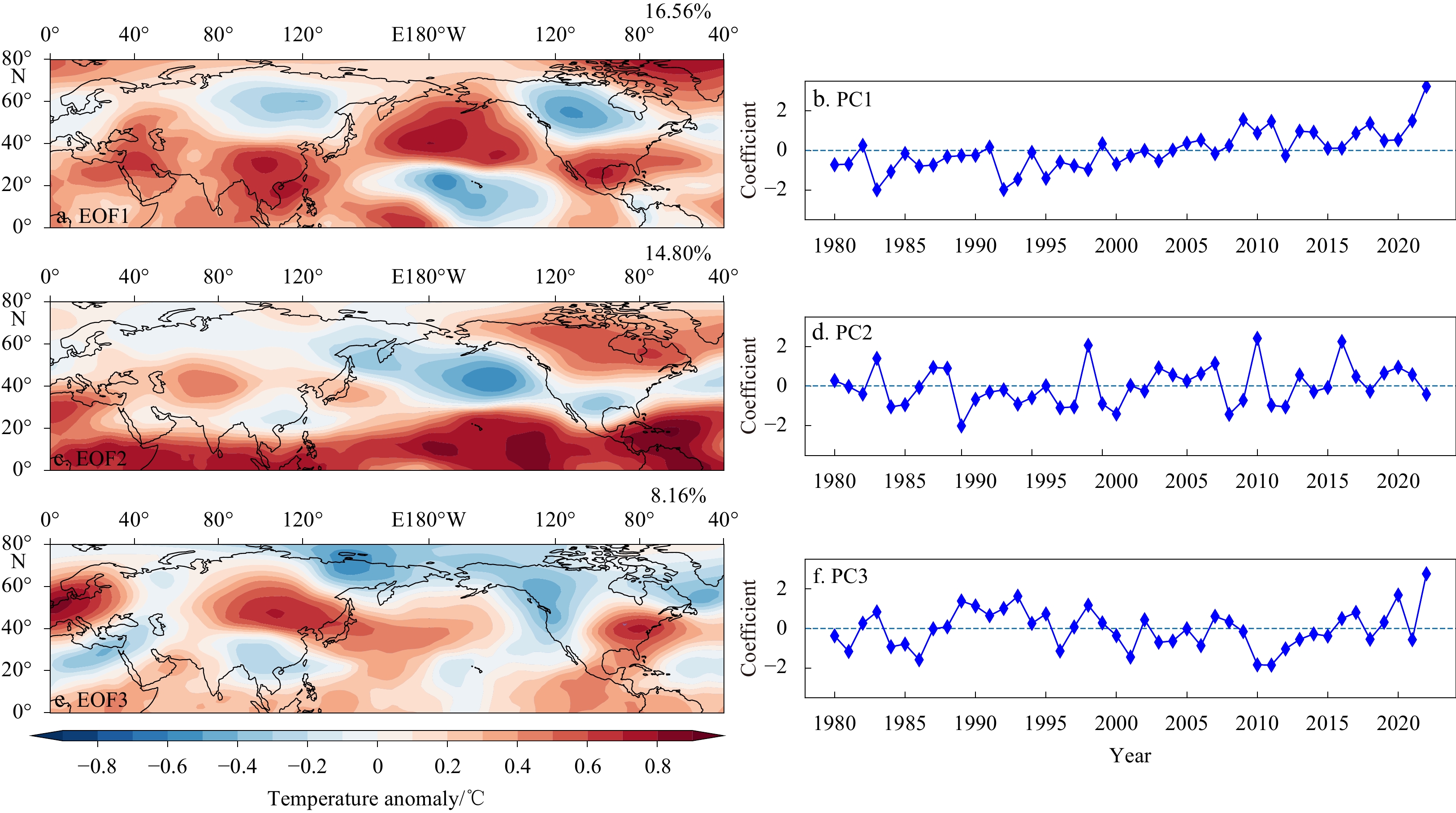
2023 Vol. 42, No. 10
Display Method:
2023, 42(10): 1-9.
doi: 10.1007/s13131-023-2187-6
Abstract:
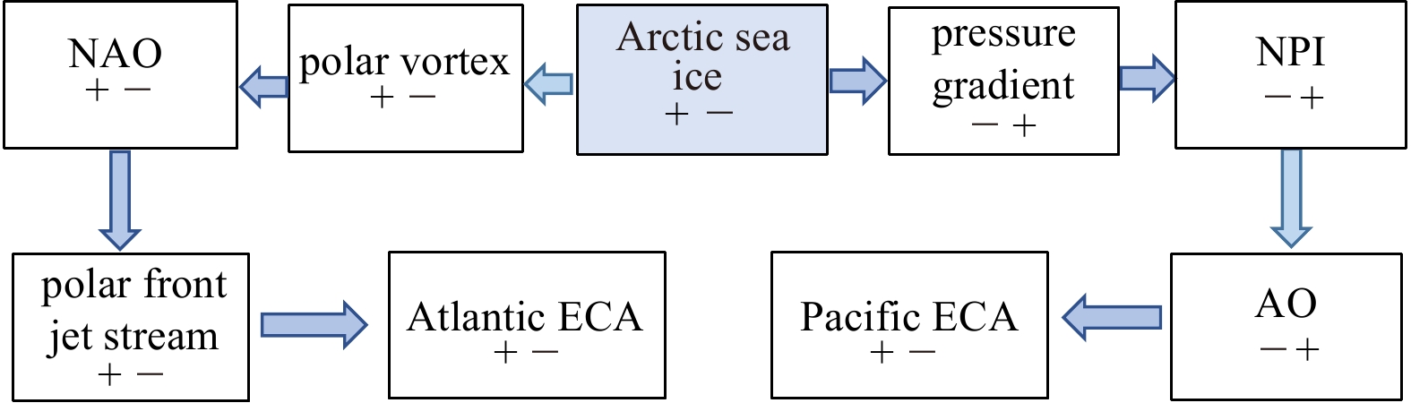
As important atmospheric circulation patterns in Northern Hemisphere (NH), the North Atlantic Oscillation (NAO) and the Western Pacific teleconnection (WP) affect the winter climate in Eurasia. In order to explore the combined effects of NAO and WP o...
As important atmospheric circulation patterns in Northern Hemisphere (NH), the North Atlantic Oscillation (NAO) and the Western Pacific teleconnection (WP) affect the winter climate in Eurasia. In order to explore the combined effects of NAO and WP o...


2023, 42(10): 10-22.
doi: 10.1007/s13131-023-2277-4
Abstract:
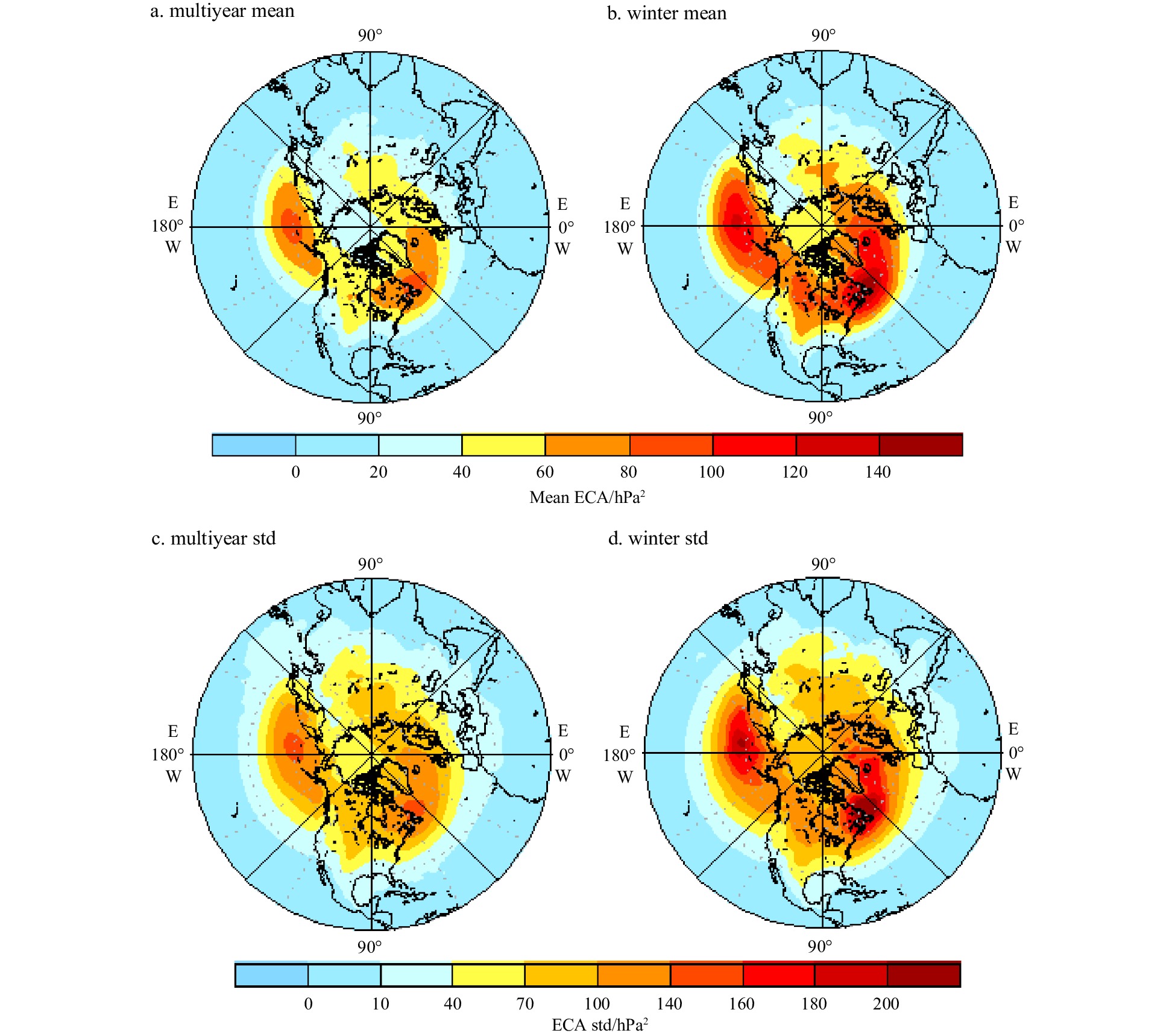
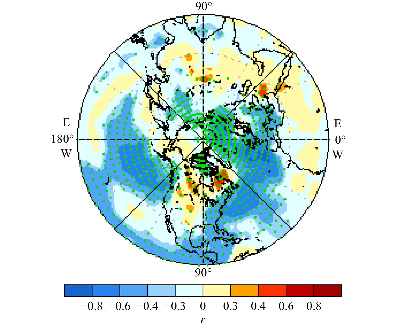
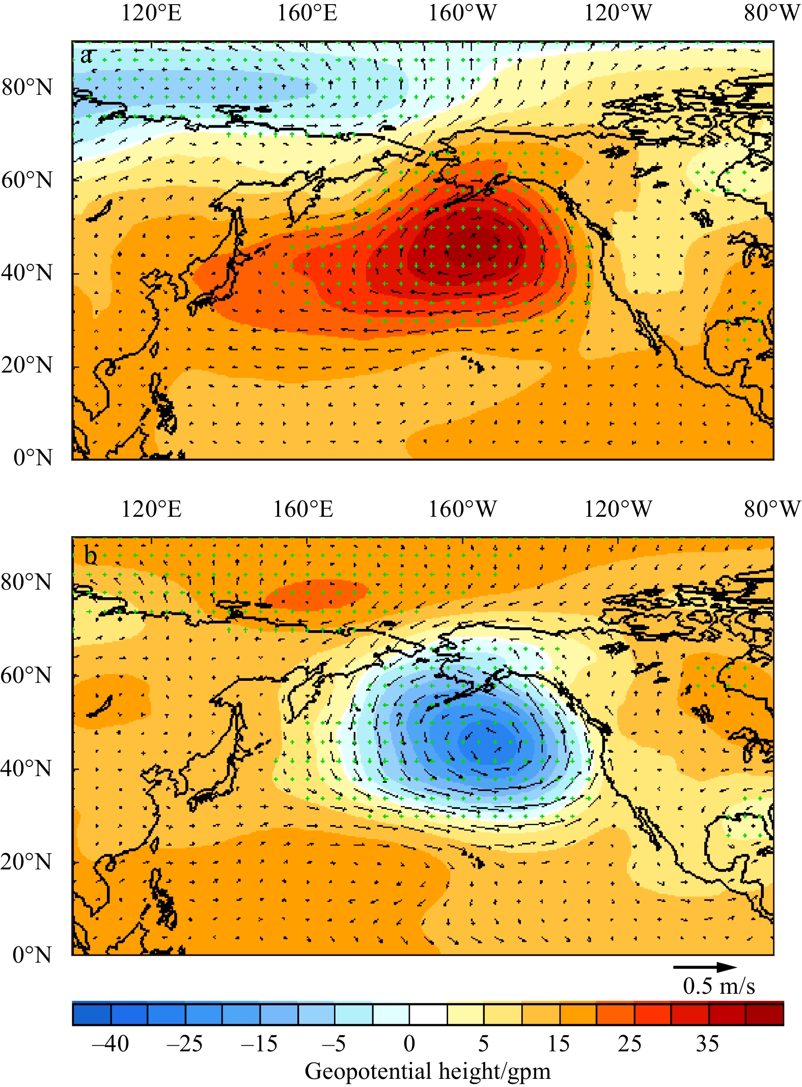
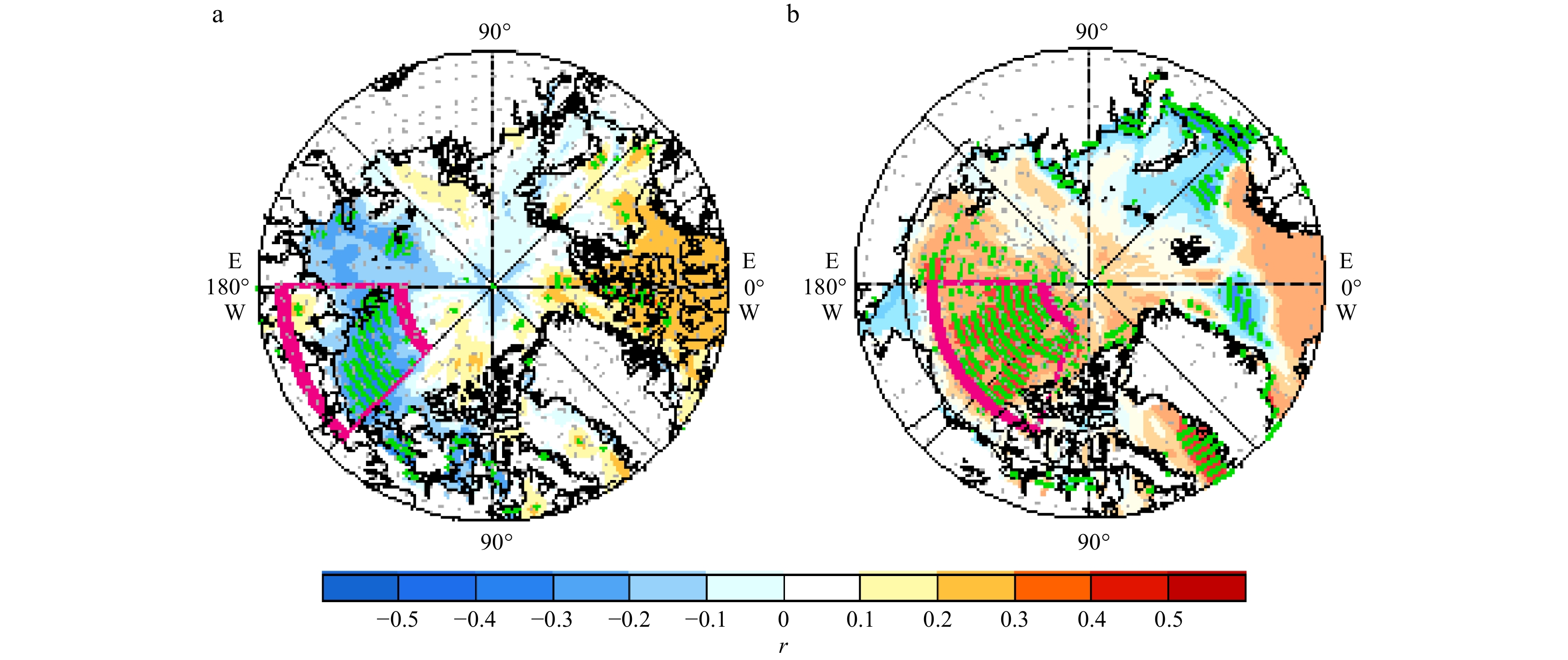
Extratropical cyclones are critical weather systems that affect large-scale weather and climate changes at mid-high latitudes. However, prior research shows that there are still great difficulties in predicting extratropical cyclones for occurrence, ...
Extratropical cyclones are critical weather systems that affect large-scale weather and climate changes at mid-high latitudes. However, prior research shows that there are still great difficulties in predicting extratropical cyclones for occurrence, ...


2023, 42(10): 23-35.
doi: 10.1007/s13131-023-2251-1
Abstract:
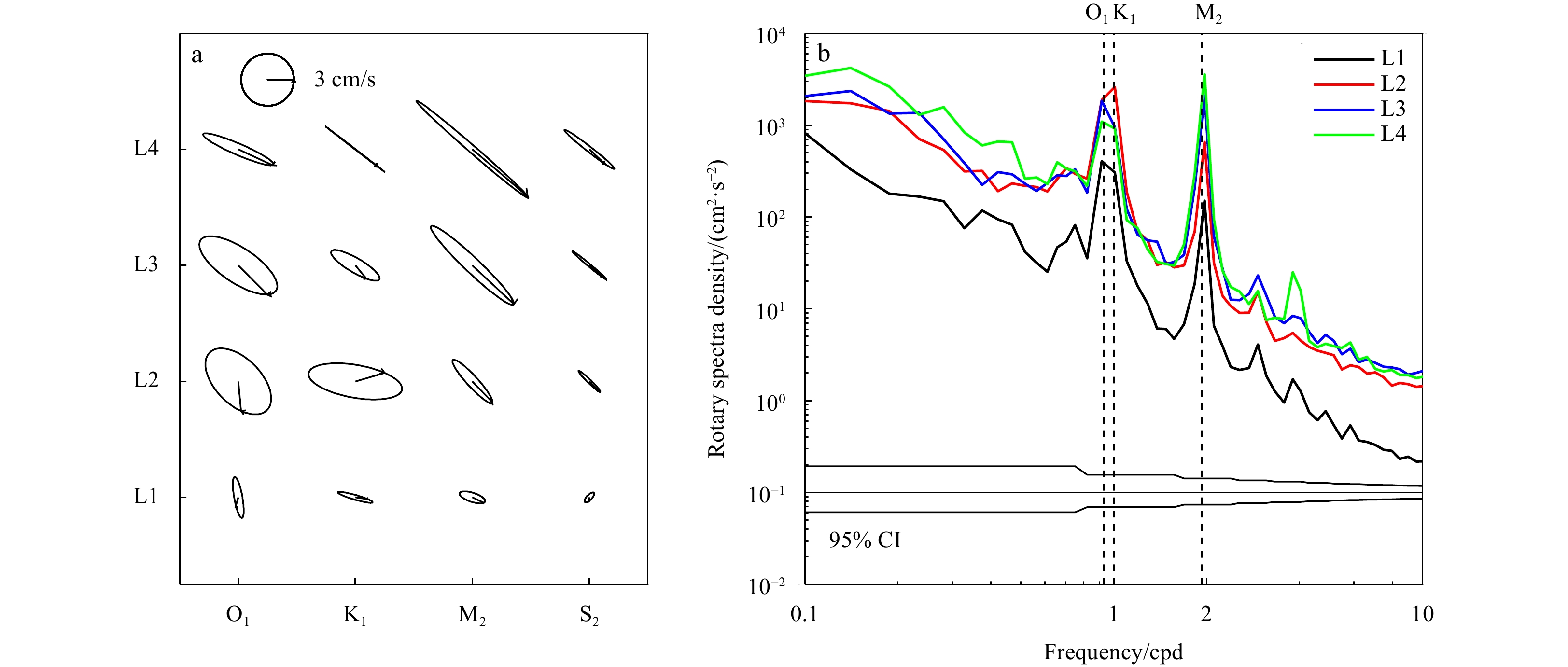
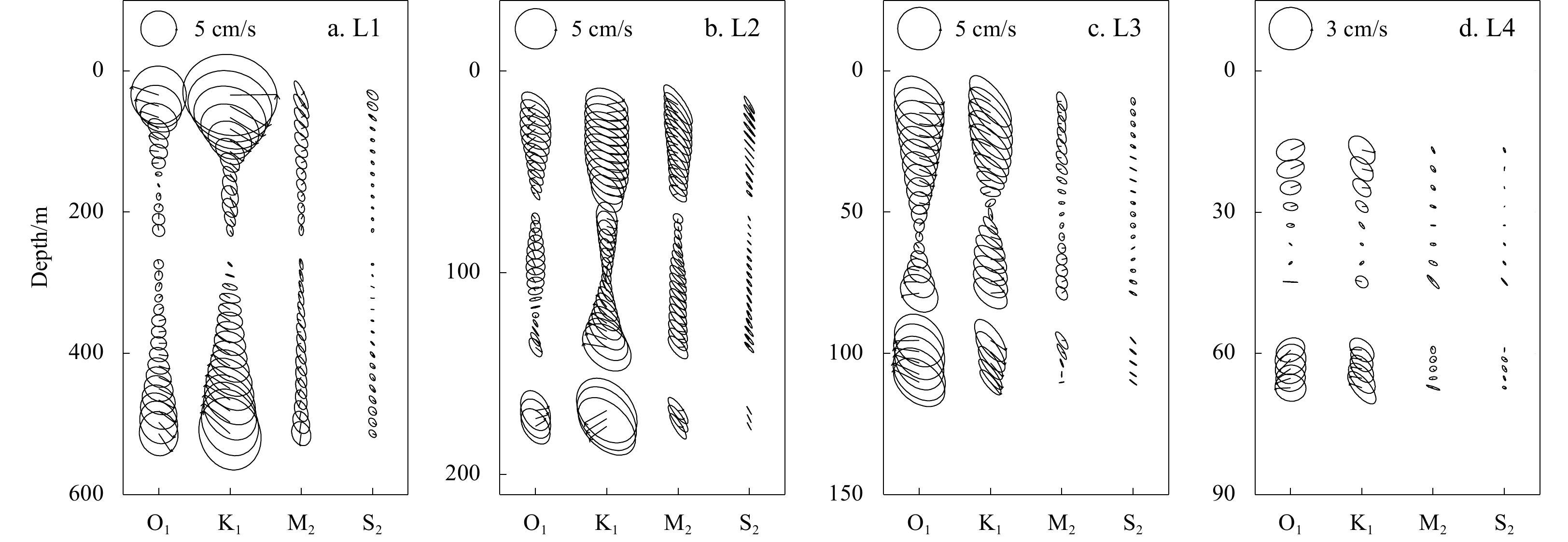
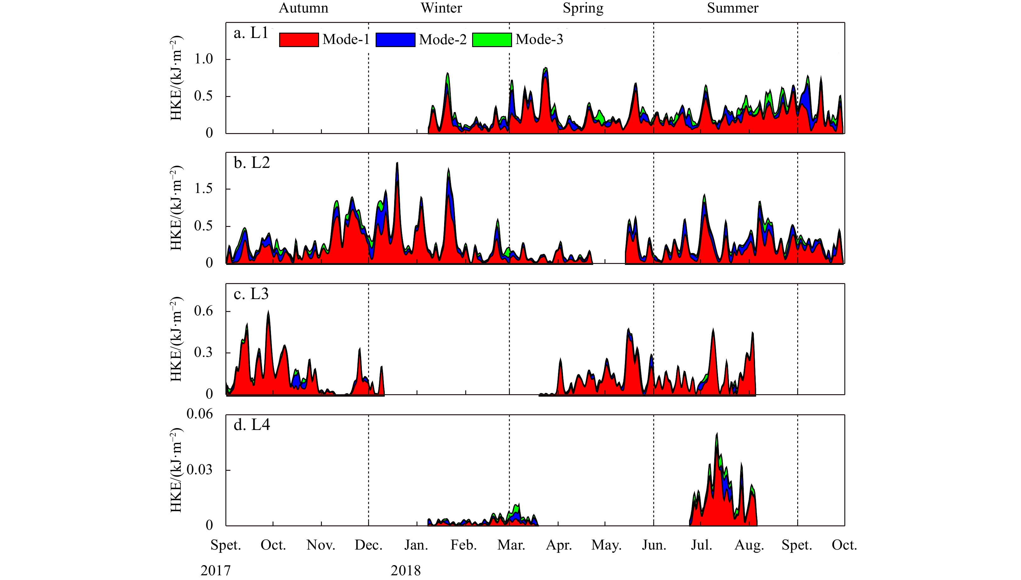
We examine the cross-shelf variation of internal tides (ITs) west of the Dongsha Plateau in the northern South China Sea based on observations from 4 moorings deployed between August 2017 and September 2018. On the slope, the amplitude of diurnal bar...
We examine the cross-shelf variation of internal tides (ITs) west of the Dongsha Plateau in the northern South China Sea based on observations from 4 moorings deployed between August 2017 and September 2018. On the slope, the amplitude of diurnal bar...


2023, 42(10): 36-53.
doi: 10.1007/s13131-023-2227-1
Abstract:
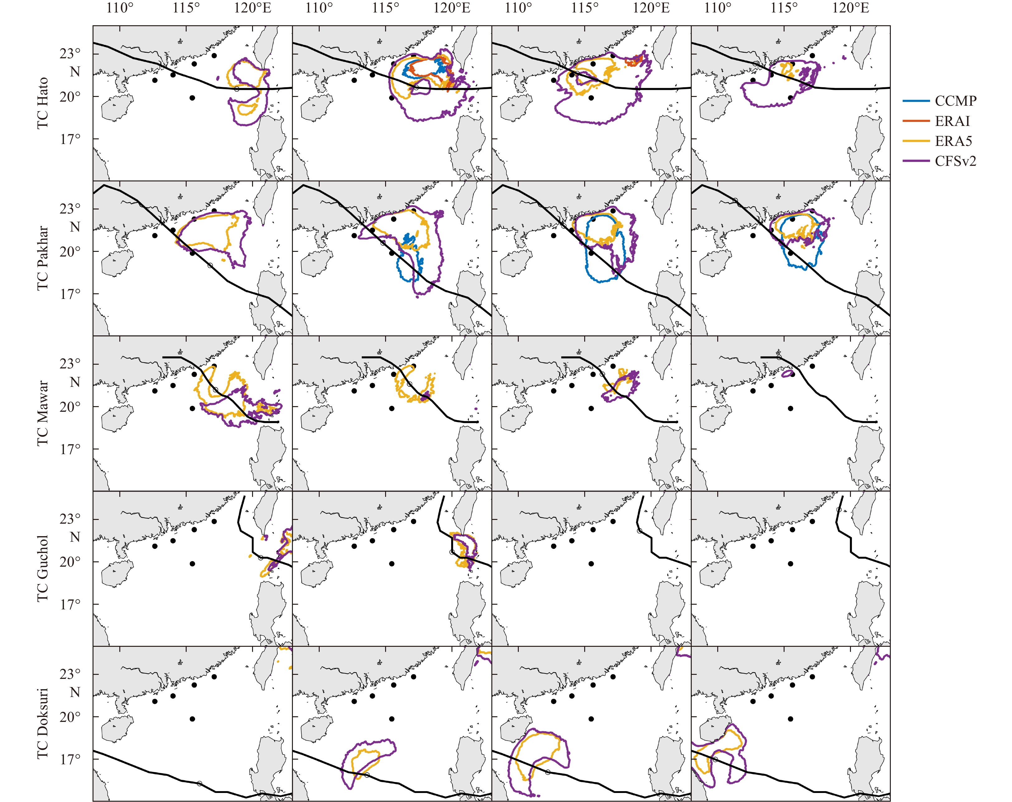
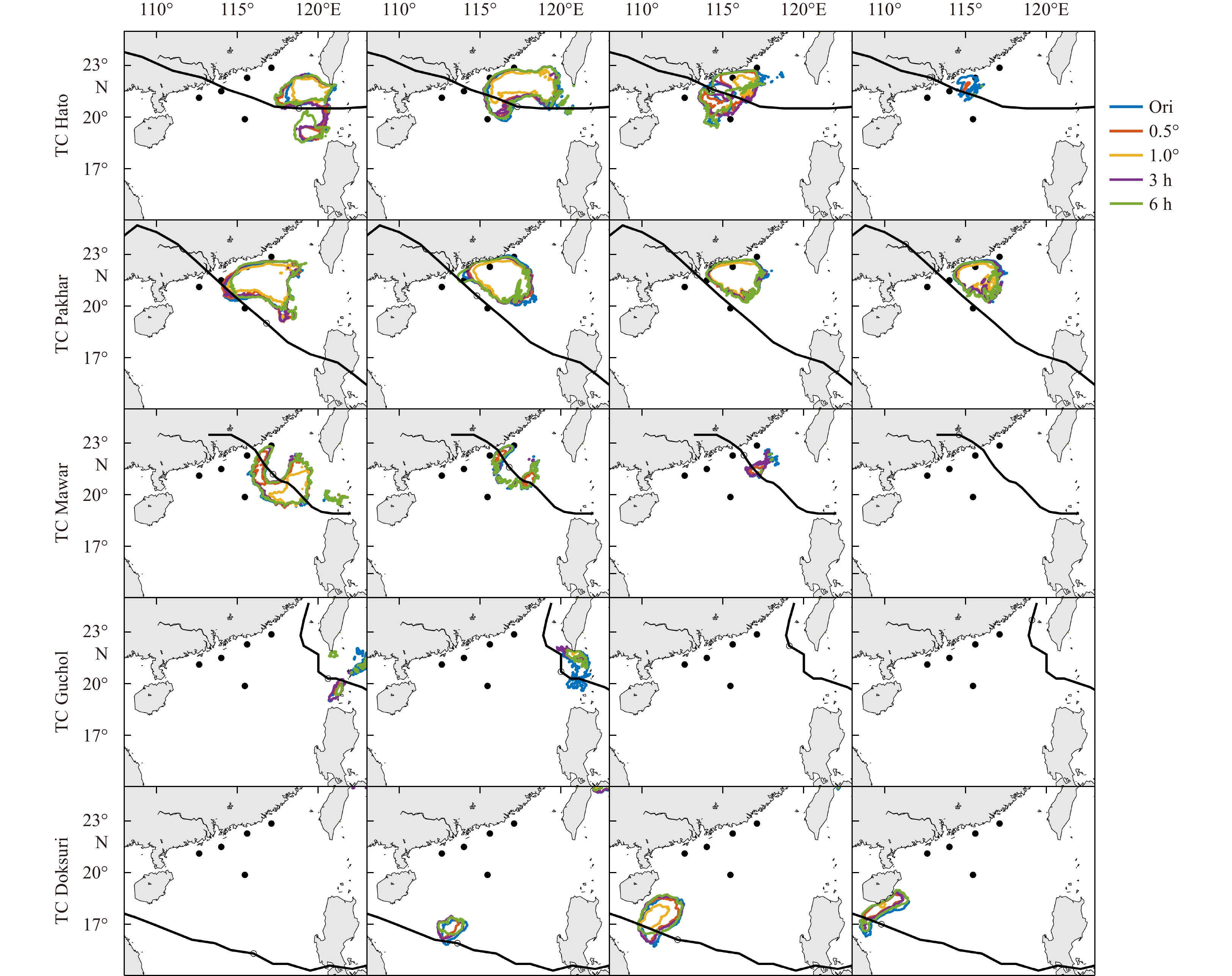
Reliable wave information is critical for marine engineering. Numerical wave models are useful tools to obtain wave information with continuous spatiotemporal distributions. However, the accuracy of model results highly depends on the quality of wind...
Reliable wave information is critical for marine engineering. Numerical wave models are useful tools to obtain wave information with continuous spatiotemporal distributions. However, the accuracy of model results highly depends on the quality of wind...


2023, 42(10): 54-66.
doi: 10.1007/s13131-023-2246-y
Abstract:
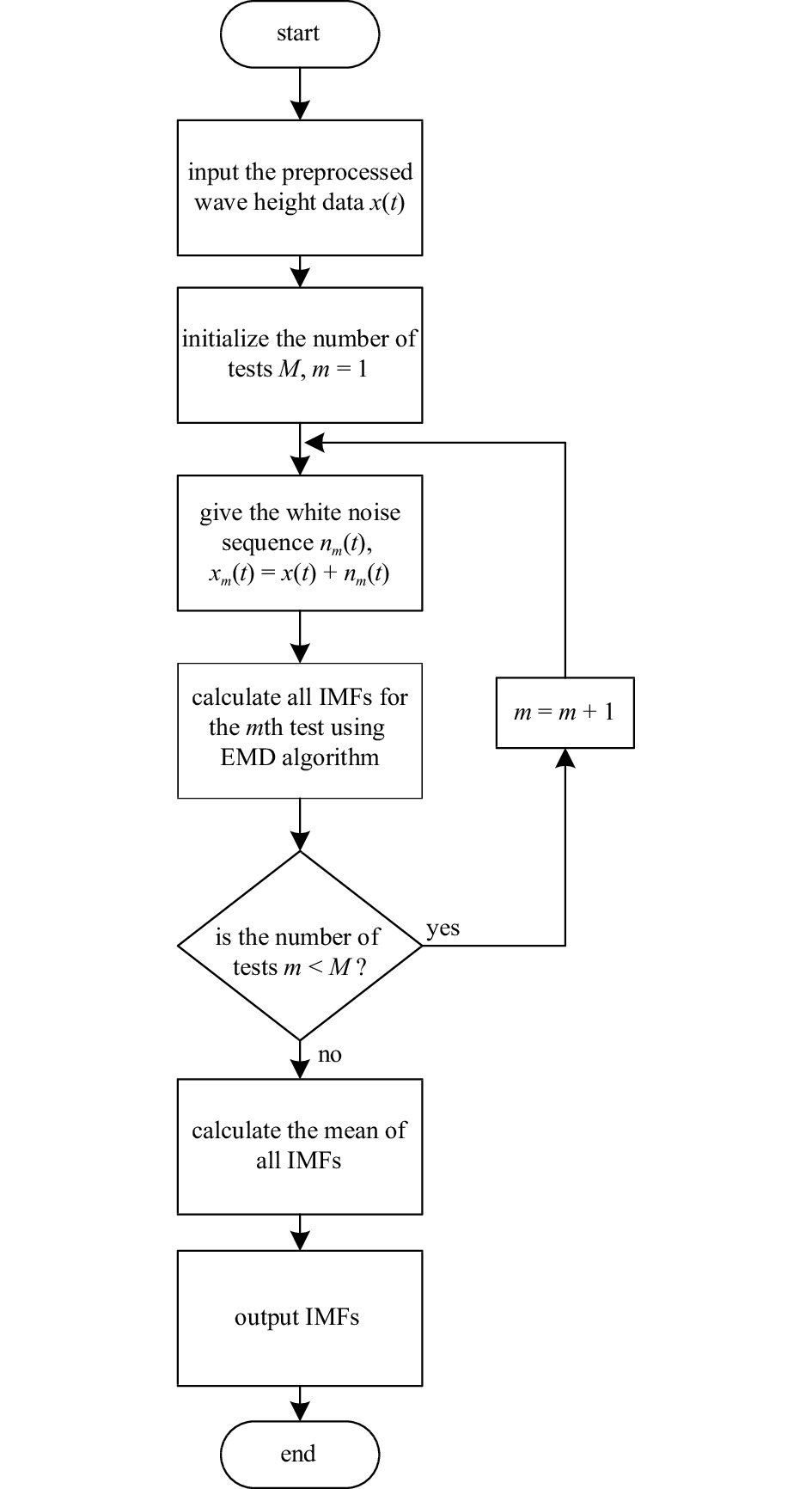
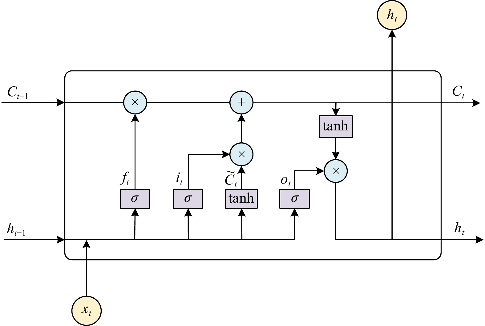
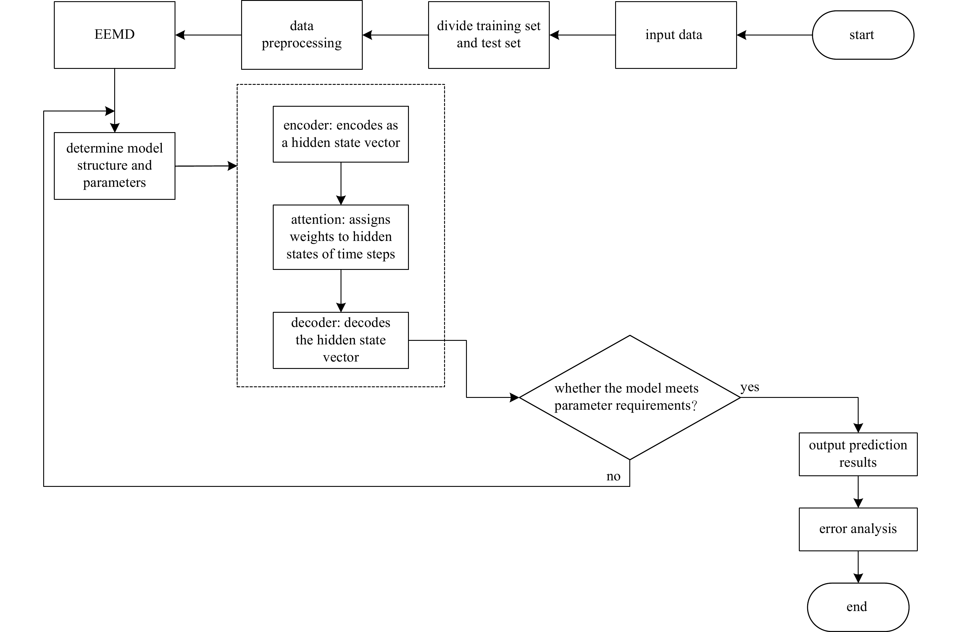
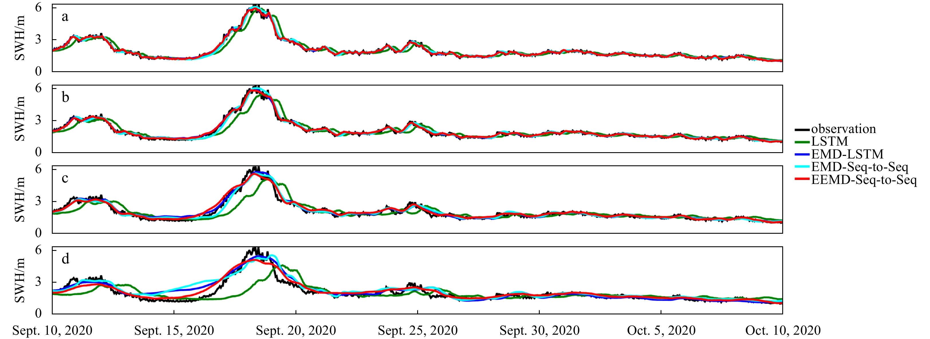
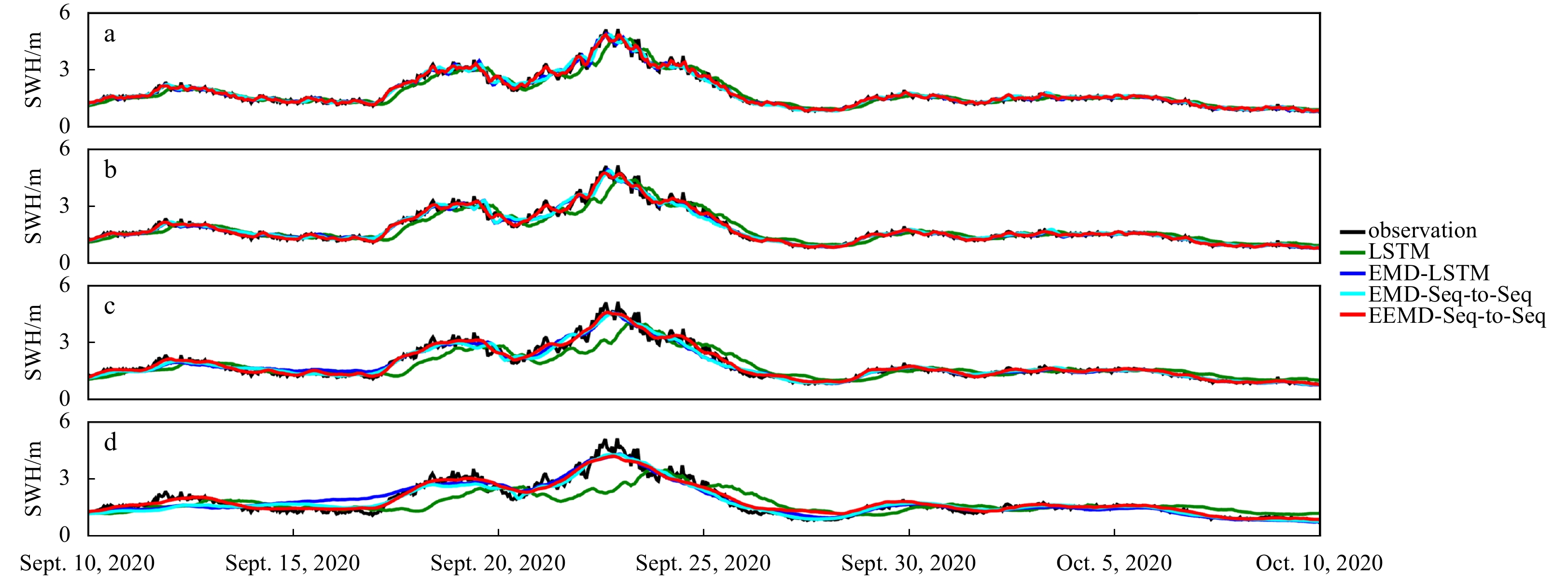
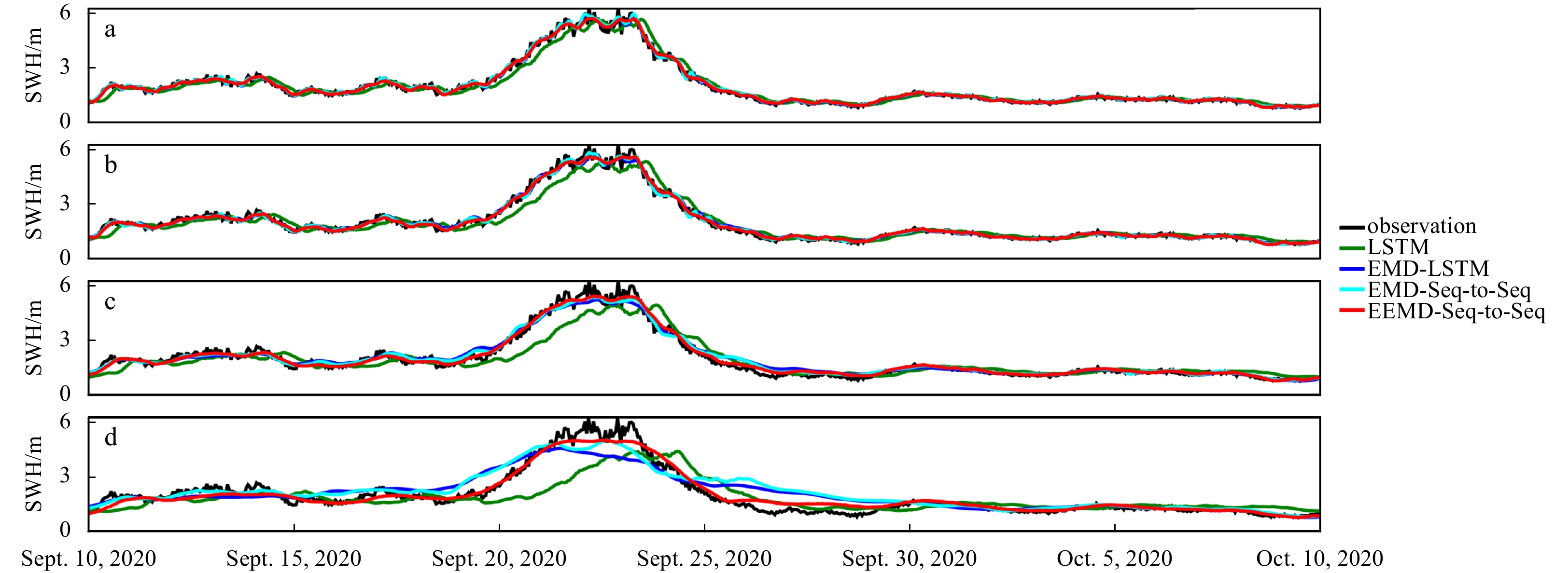
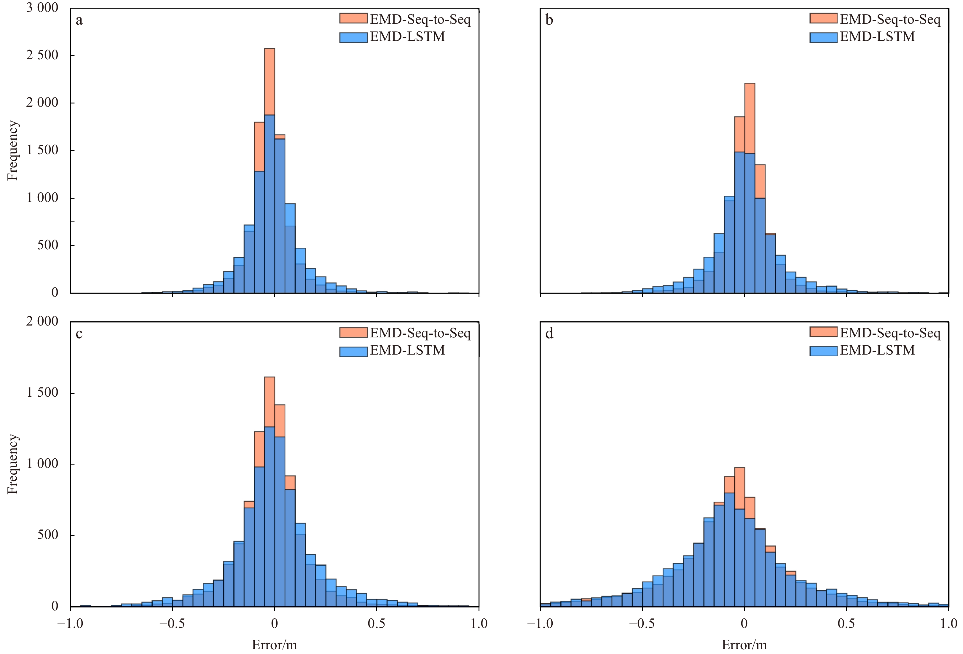
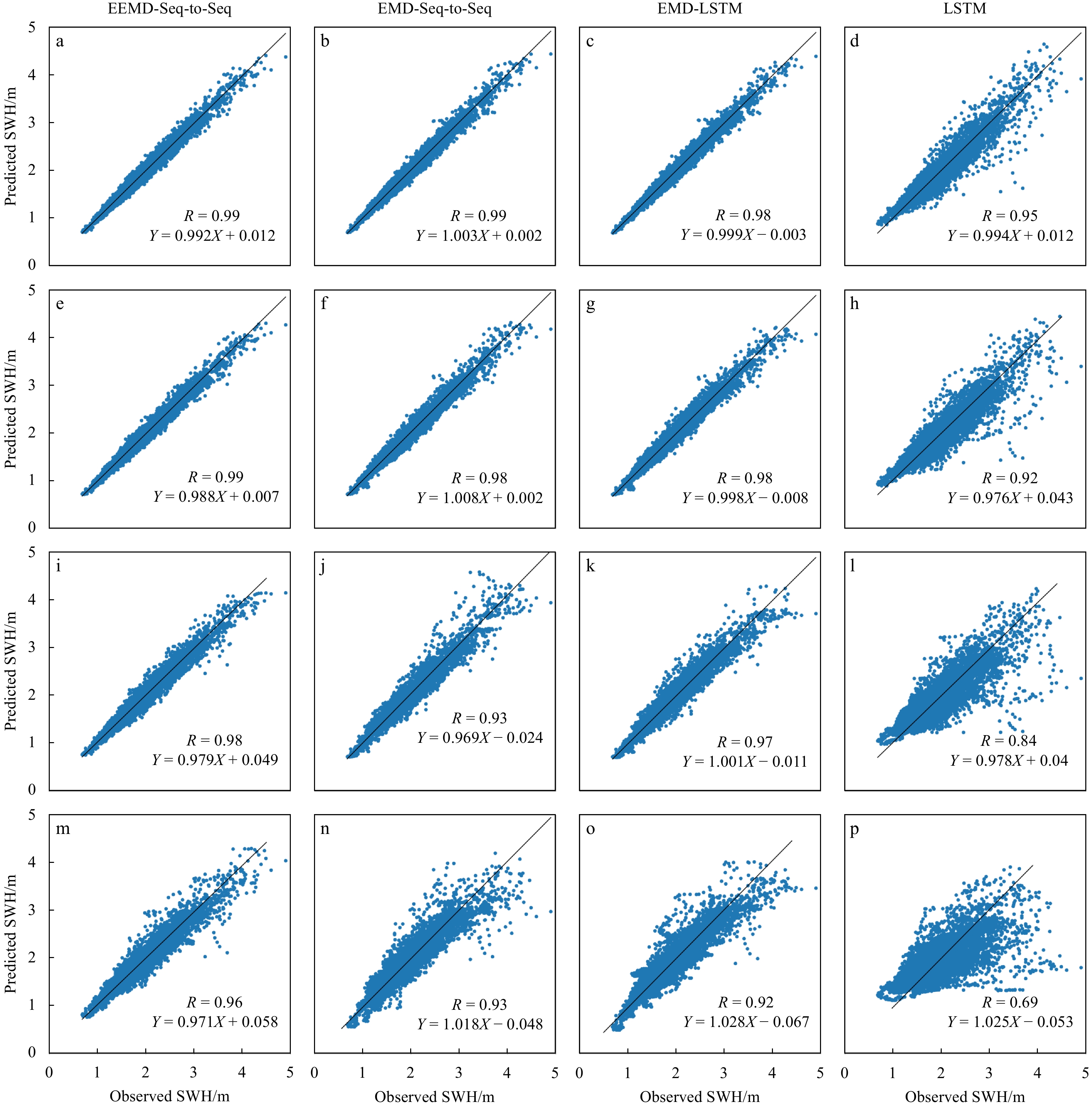
As wave height is an important parameter in marine climate measurement, its accurate prediction is crucial in ocean engineering. It also plays an important role in marine disaster early warning and ship design, etc. However, challenges in the large d...
As wave height is an important parameter in marine climate measurement, its accurate prediction is crucial in ocean engineering. It also plays an important role in marine disaster early warning and ship design, etc. However, challenges in the large d...


2023, 42(10): 67-74.
doi: 10.1007/s13131-023-2206-6
Abstract:
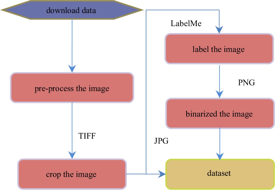
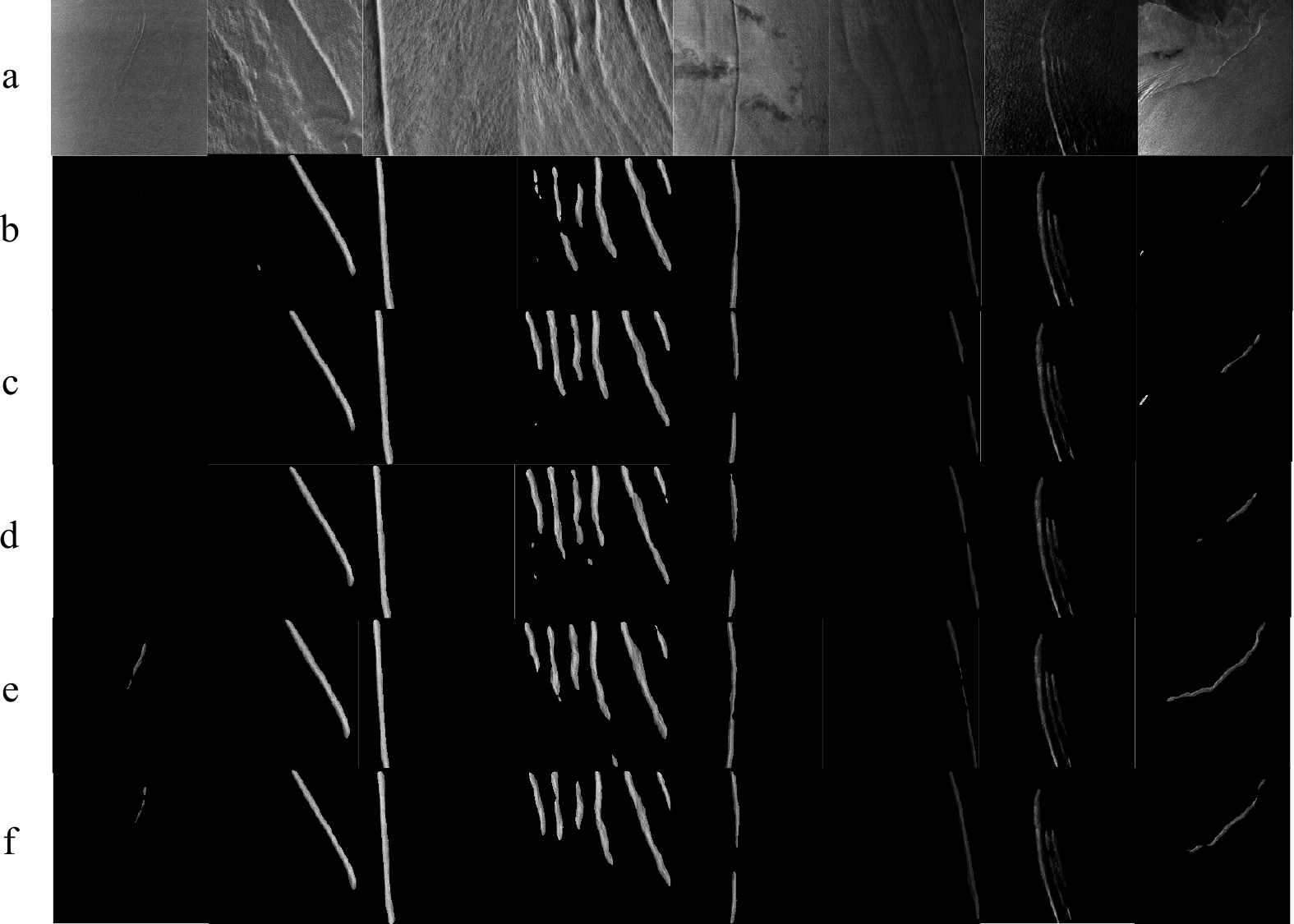
The development of oceanic remote sensing artificial intelligence has made possible to obtain valuable information from amounts of massive data. Oceanic internal waves play a crucial role in oceanic activity. To obtain oceanic internal wave stripes f...
The development of oceanic remote sensing artificial intelligence has made possible to obtain valuable information from amounts of massive data. Oceanic internal waves play a crucial role in oceanic activity. To obtain oceanic internal wave stripes f...


2023, 42(10): 75-83.
doi: 10.1007/s13131-022-2110-5
Abstract:
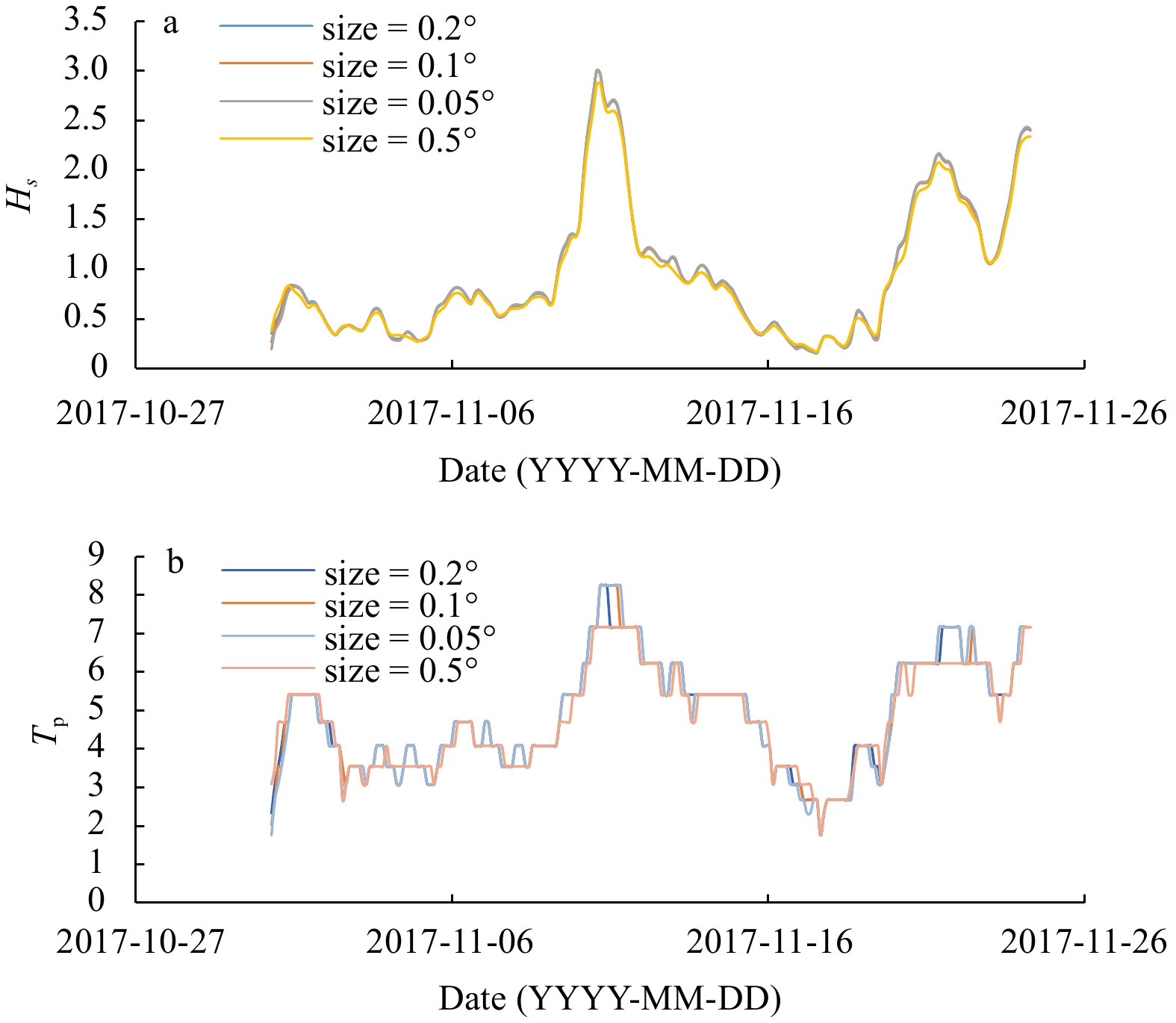
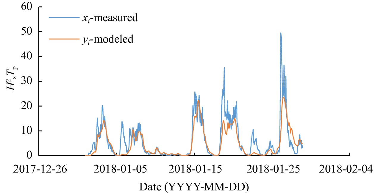
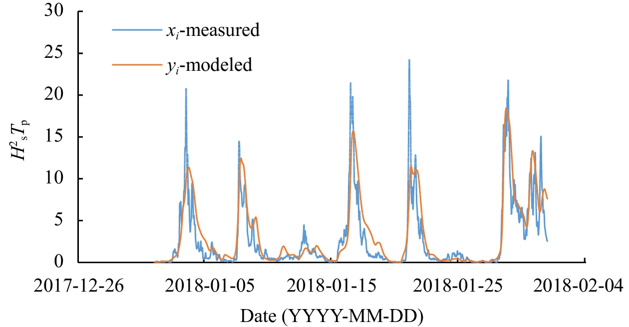
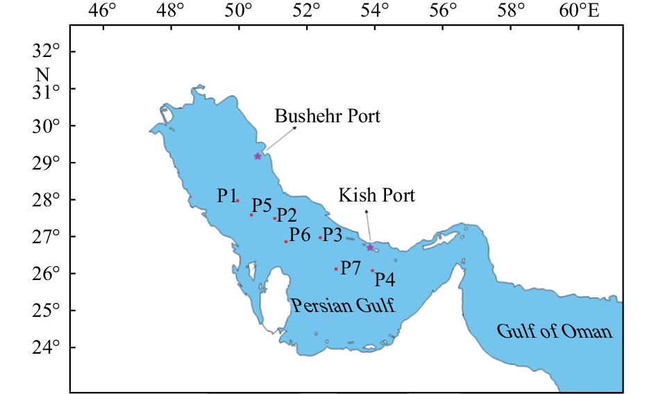
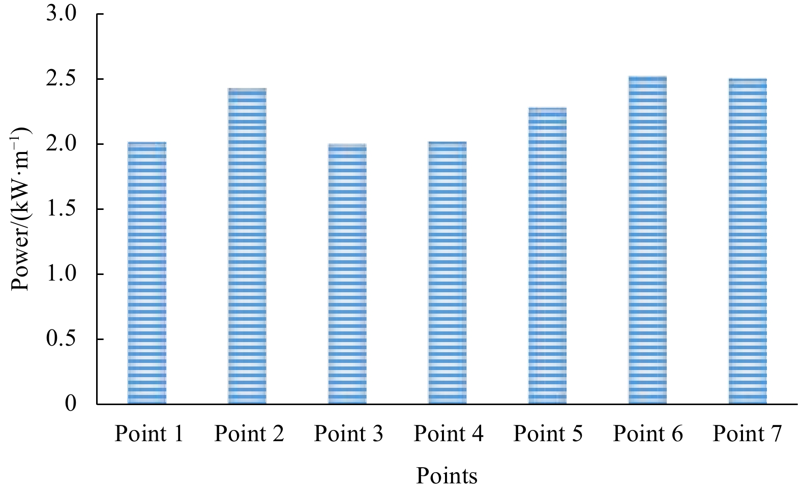
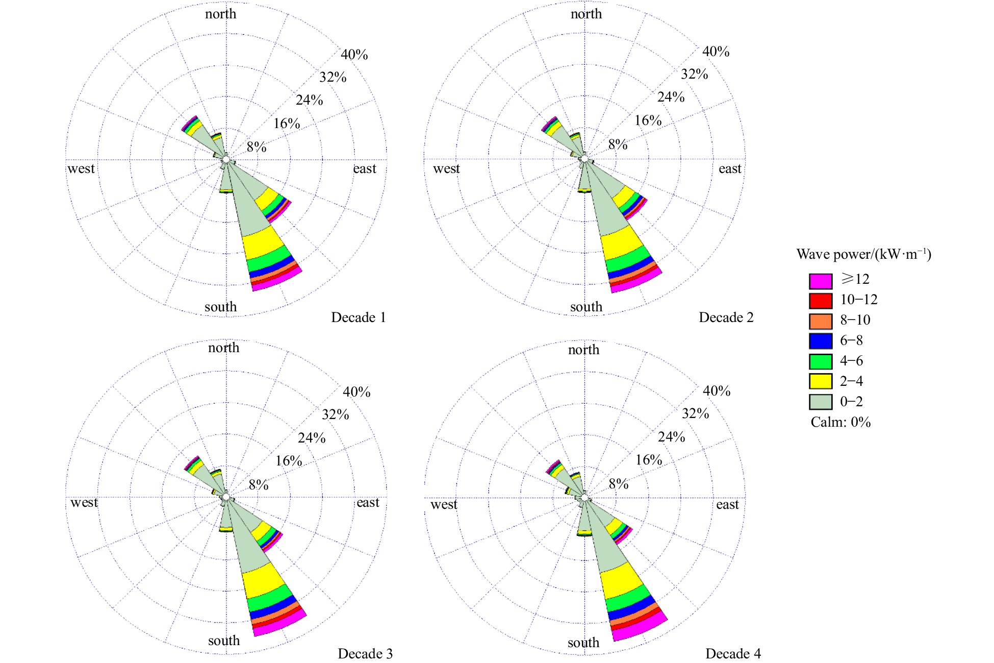
The wave power in high potential area of the northern Persian Gulf (near to Iranian coastal areas) is assessed by taking into account the temporal and spatial distributions of wave power for a period of forty years. For this purpose, assimilated wind...
The wave power in high potential area of the northern Persian Gulf (near to Iranian coastal areas) is assessed by taking into account the temporal and spatial distributions of wave power for a period of forty years. For this purpose, assimilated wind...


2023, 42(10): 84-96.
doi: 10.1007/s13131-023-2215-5
Abstract:
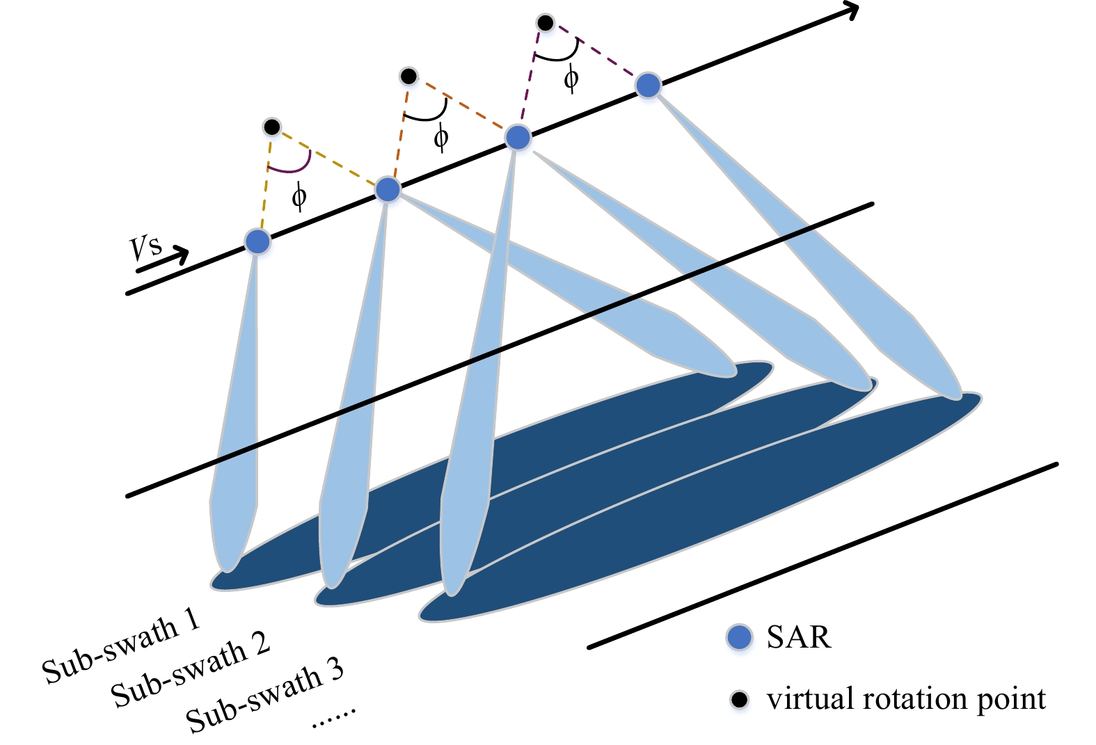
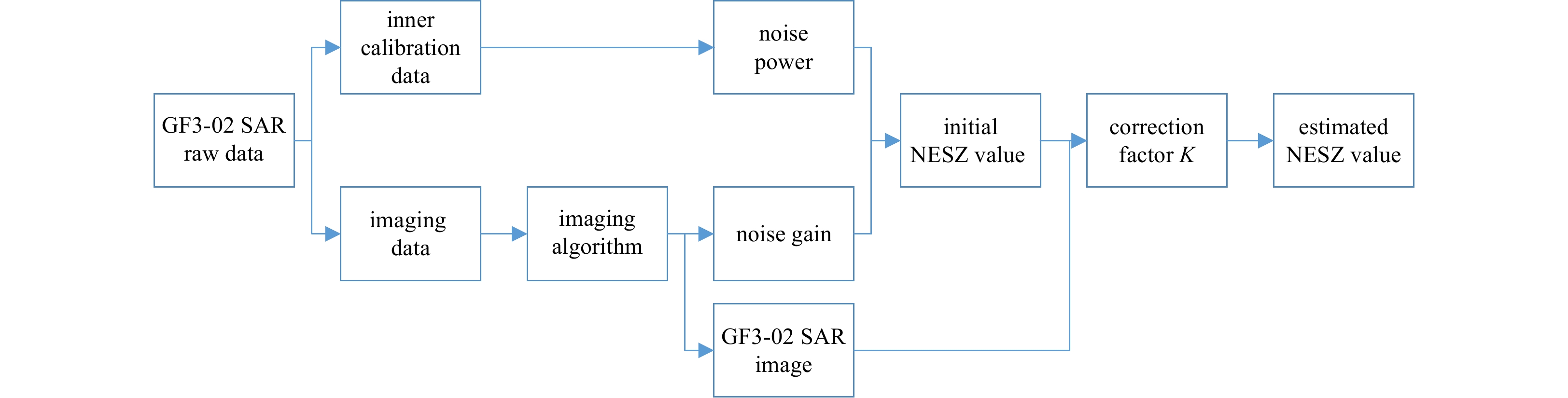
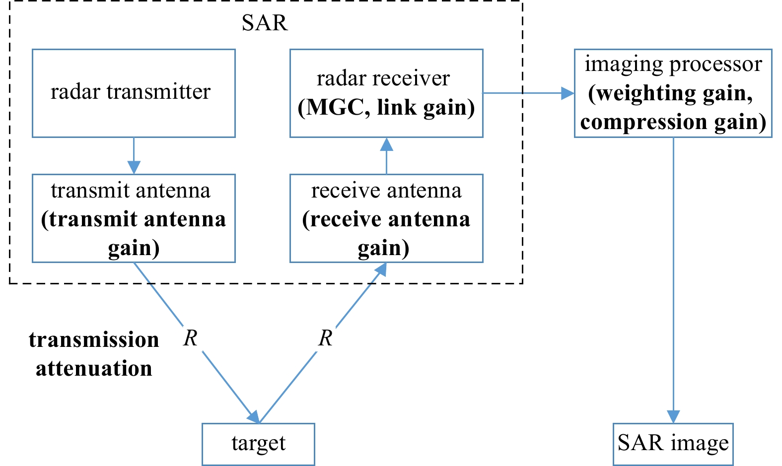
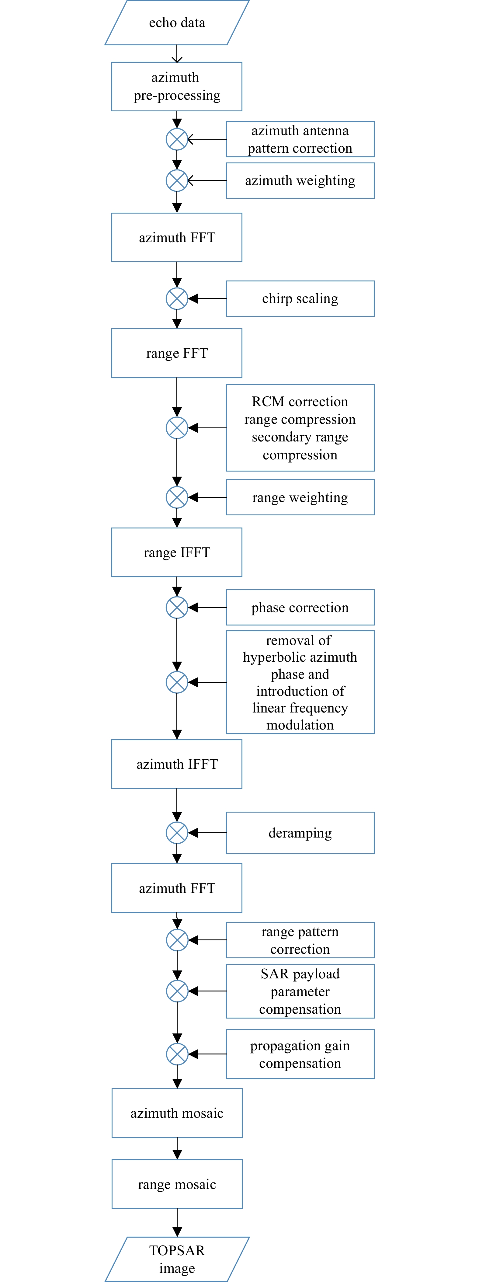
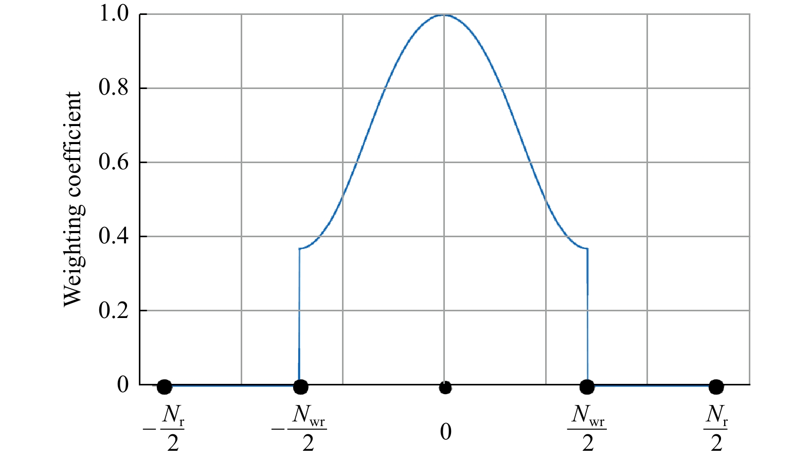
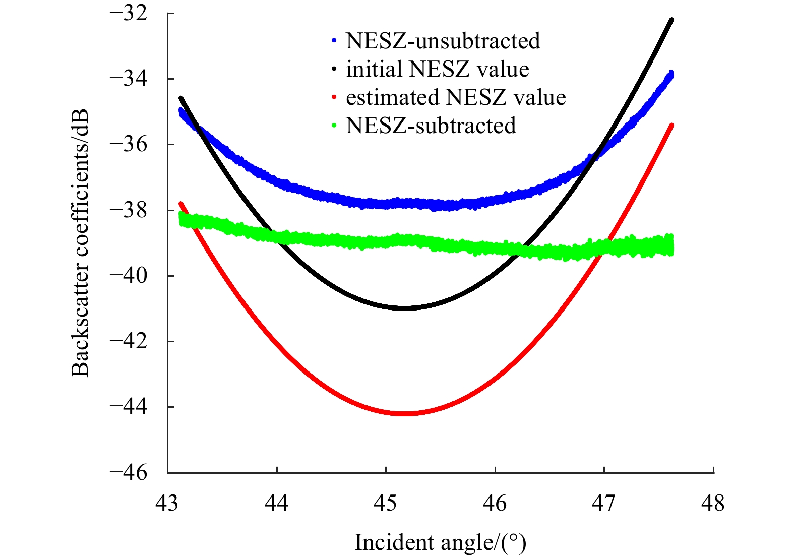
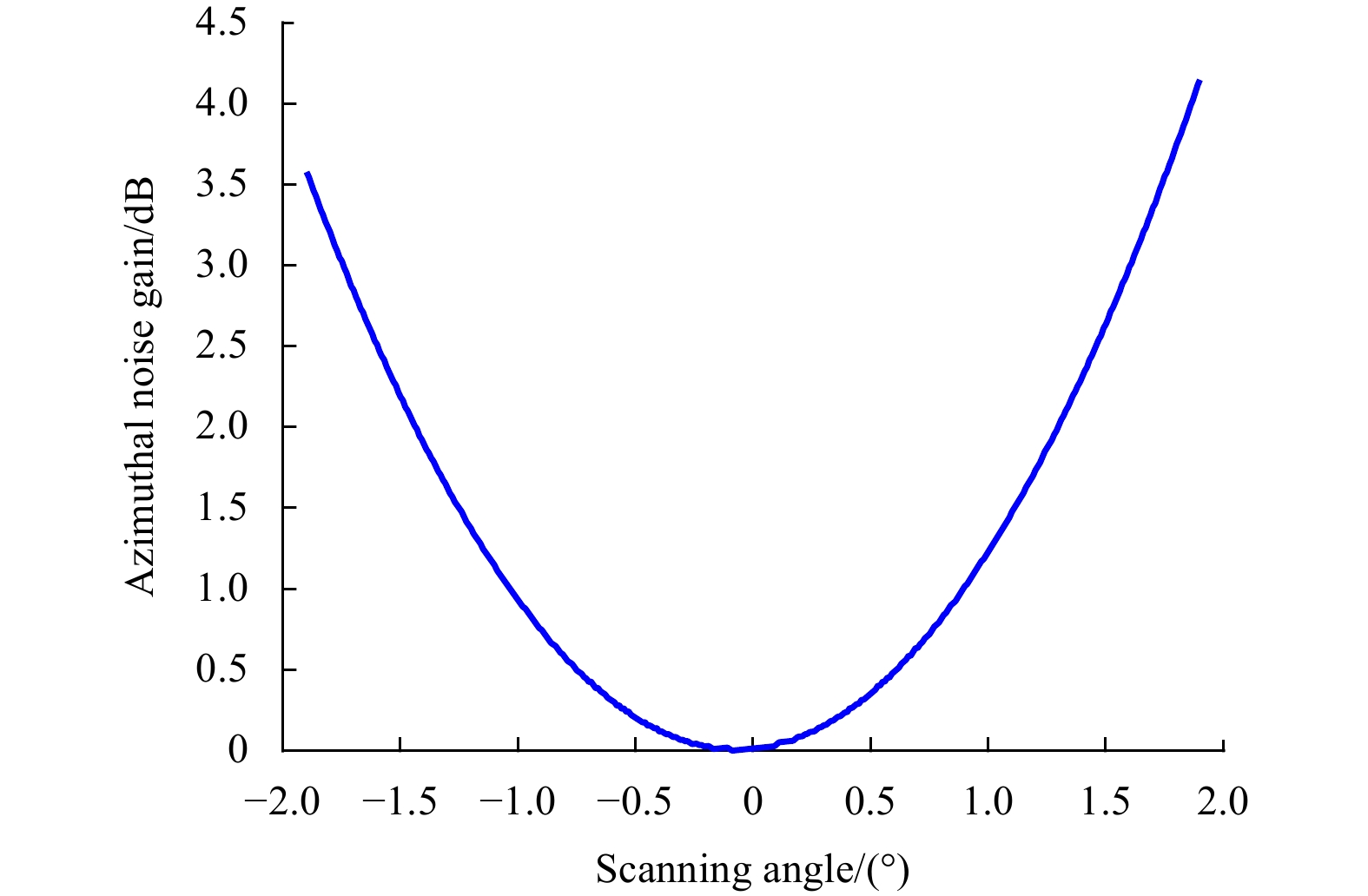
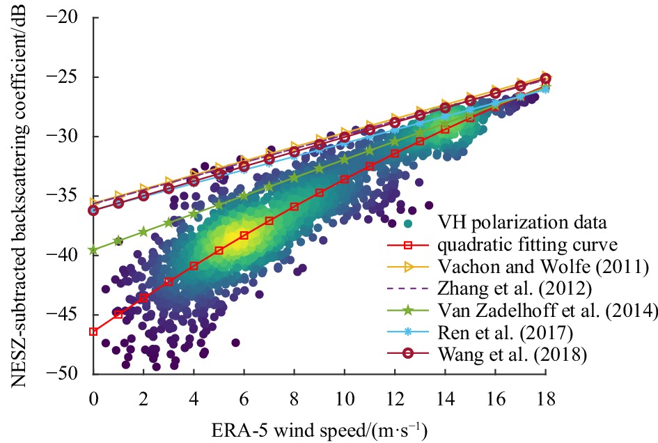
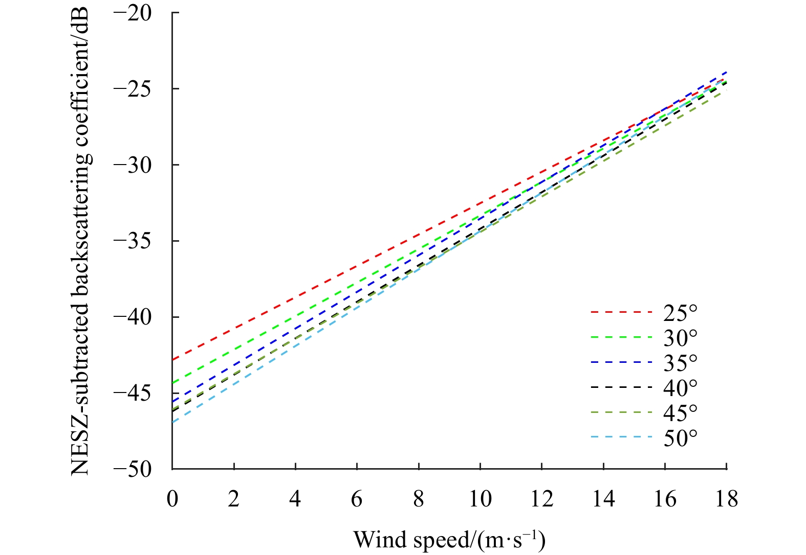
Gaofen-3-02 (GF3-02) is the first C-band synthetic aperture radar (SAR) satellite with terrain observation with progressive scans of SAR (TOPSAR) imaging mode in China, which plays an essential role in marine environment monitoring. Given the weak sc...
Gaofen-3-02 (GF3-02) is the first C-band synthetic aperture radar (SAR) satellite with terrain observation with progressive scans of SAR (TOPSAR) imaging mode in China, which plays an essential role in marine environment monitoring. Given the weak sc...


2023, 42(10): 97-107.
doi: 10.1007/s13131-023-2149-y
Abstract:
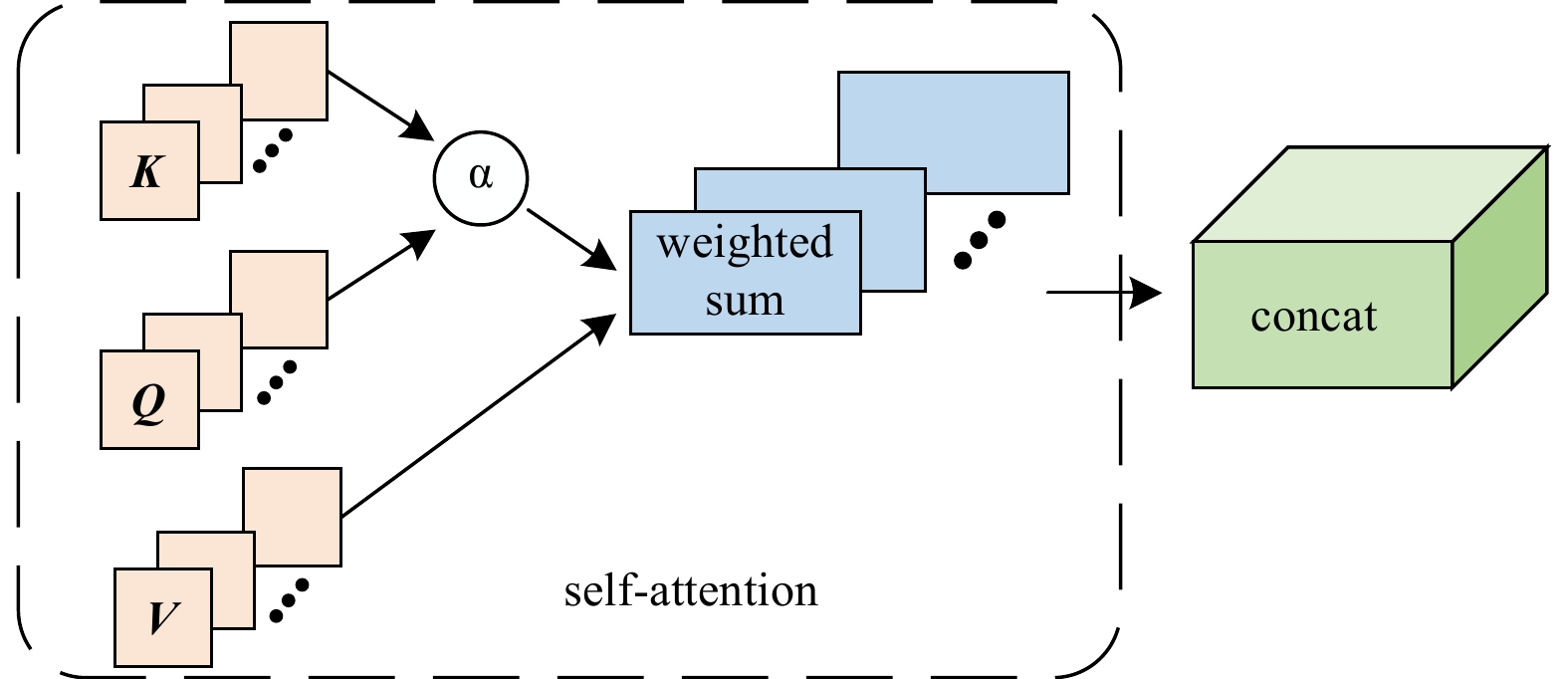
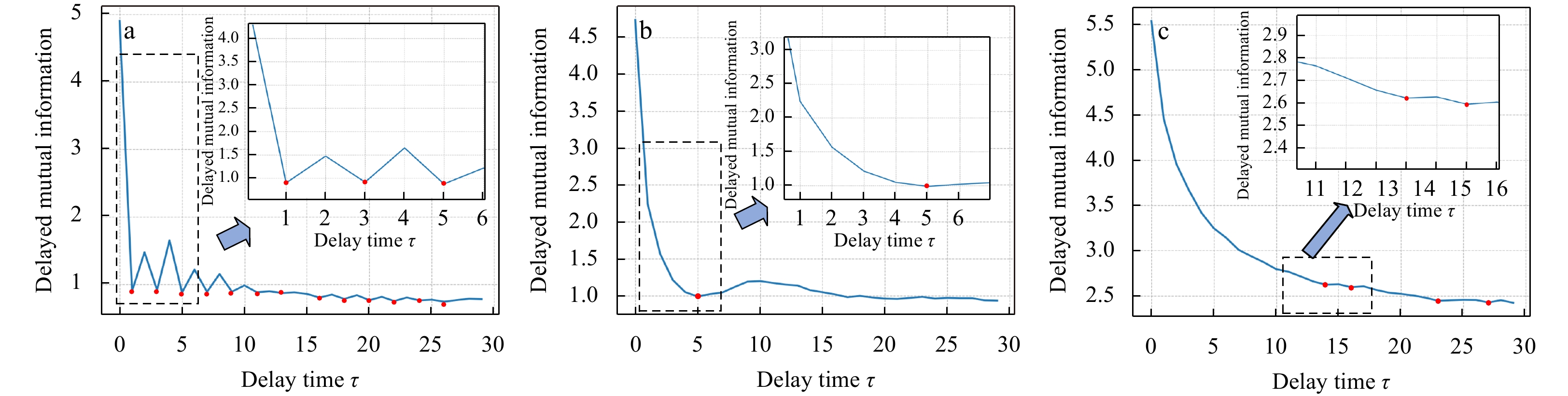
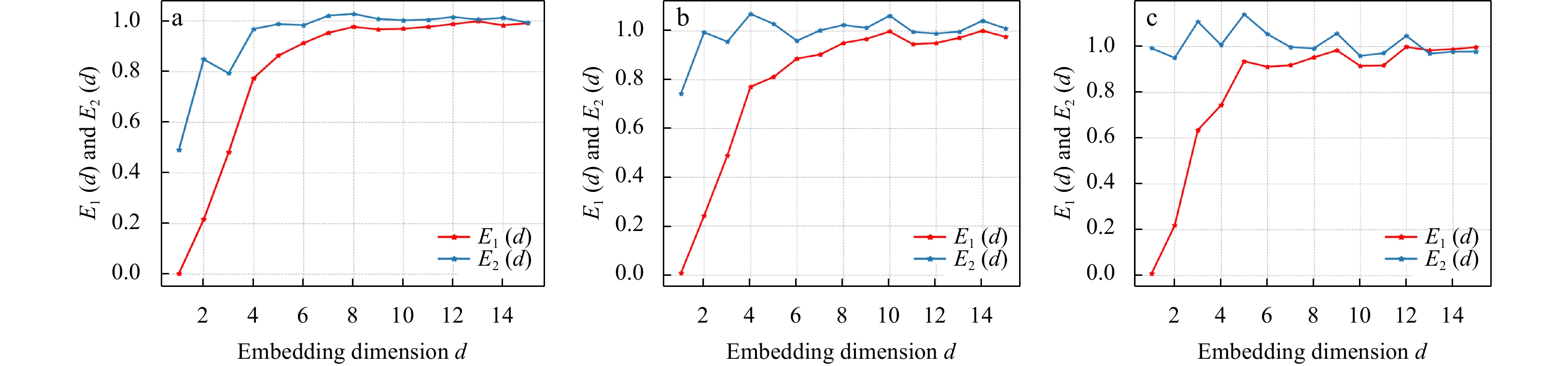
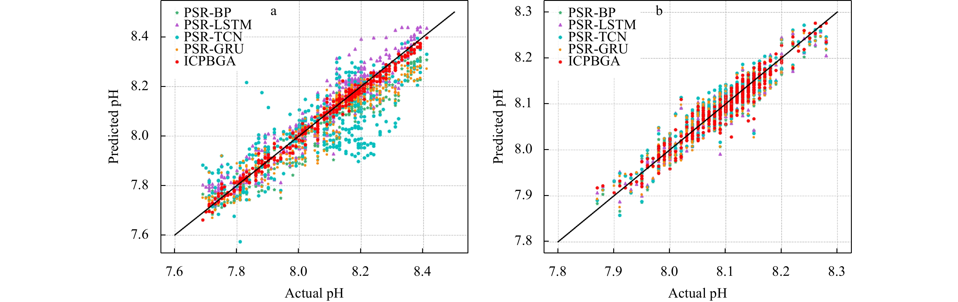
Marine life is very sensitive to changes in pH. Even slight changes can cause ecosystems to collapse. Therefore, understanding the future pH of seawater is of great significance for the protection of the marine environment. At present, the monitoring...
Marine life is very sensitive to changes in pH. Even slight changes can cause ecosystems to collapse. Therefore, understanding the future pH of seawater is of great significance for the protection of the marine environment. At present, the monitoring...


2023, 42(10): 108-116.
doi: 10.1007/s13131-022-2094-1
Abstract:
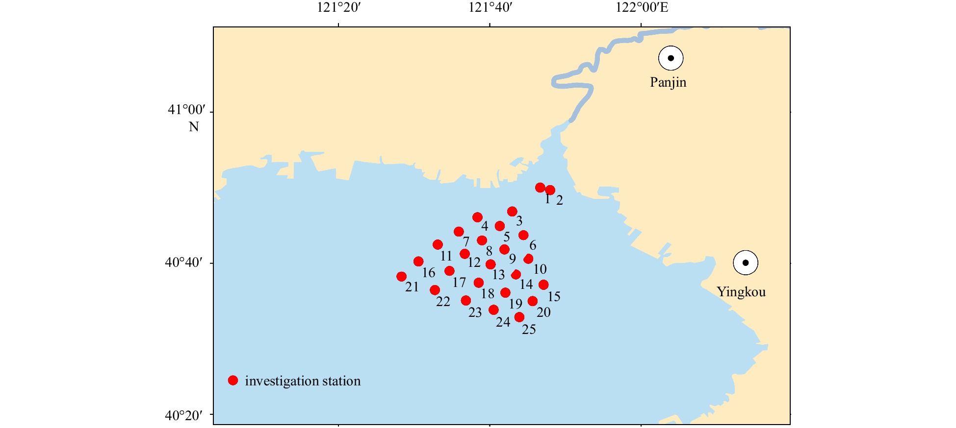
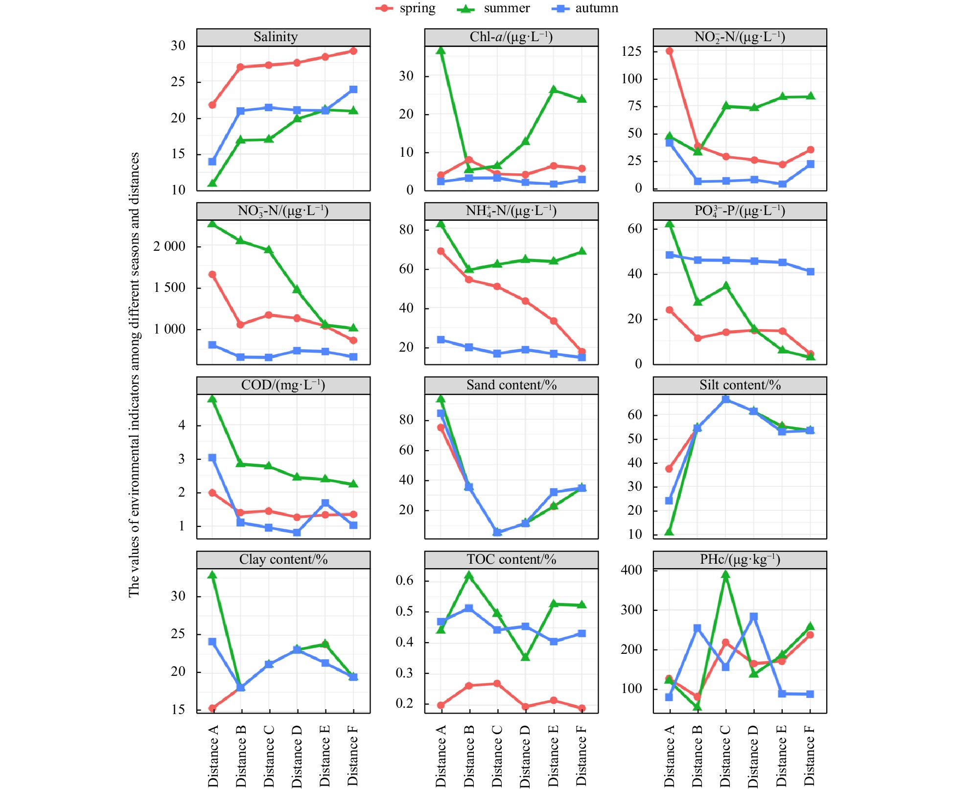
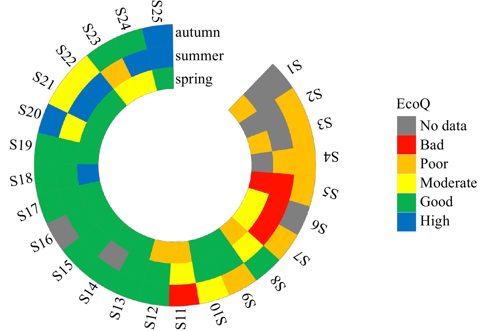
Taxonomic sufficiency (TS) refers to identifying taxa to a taxonomic level sufficient to detect community changes in stressed environments and may provide a cost-effective approach in routine monitoring programs. However, there is still limited infor...
Taxonomic sufficiency (TS) refers to identifying taxa to a taxonomic level sufficient to detect community changes in stressed environments and may provide a cost-effective approach in routine monitoring programs. However, there is still limited infor...


2023, 42(10): 117-126.
doi: 10.1007/s13131-023-2207-5
Abstract:
In China, operational in-situ marine monitoring is the primary means of directly obtaining hydrological, meteorological, and oceanographic environmental parameters across sea areas, and it is essential for applications such as forecast of marine envi...
In China, operational in-situ marine monitoring is the primary means of directly obtaining hydrological, meteorological, and oceanographic environmental parameters across sea areas, and it is essential for applications such as forecast of marine envi...


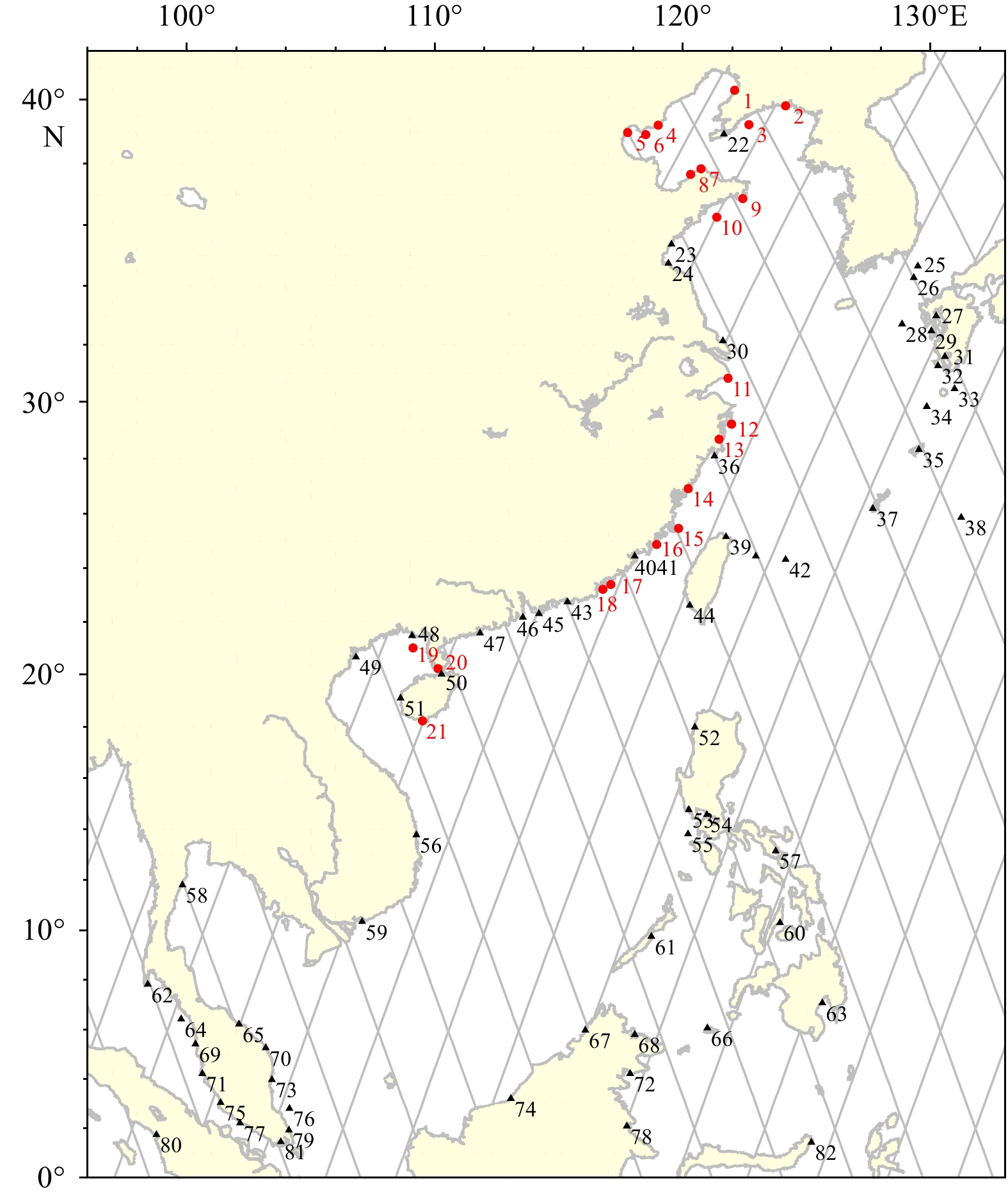
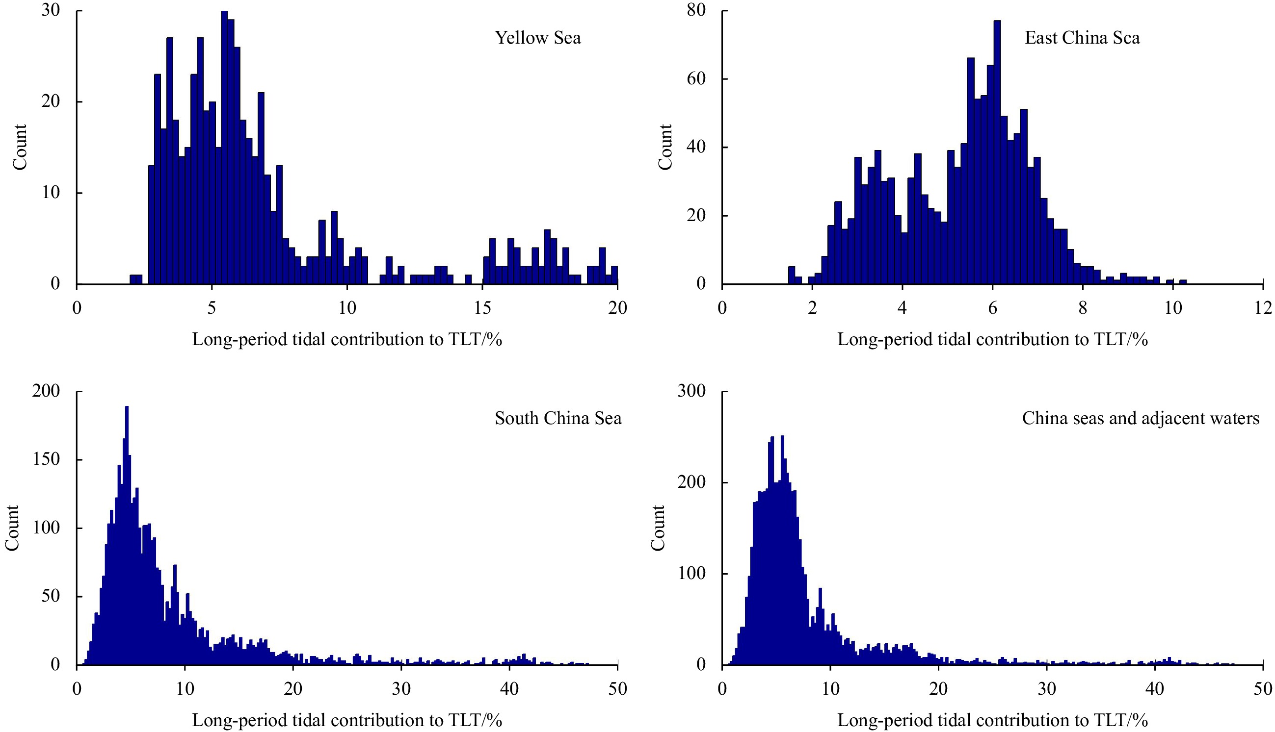
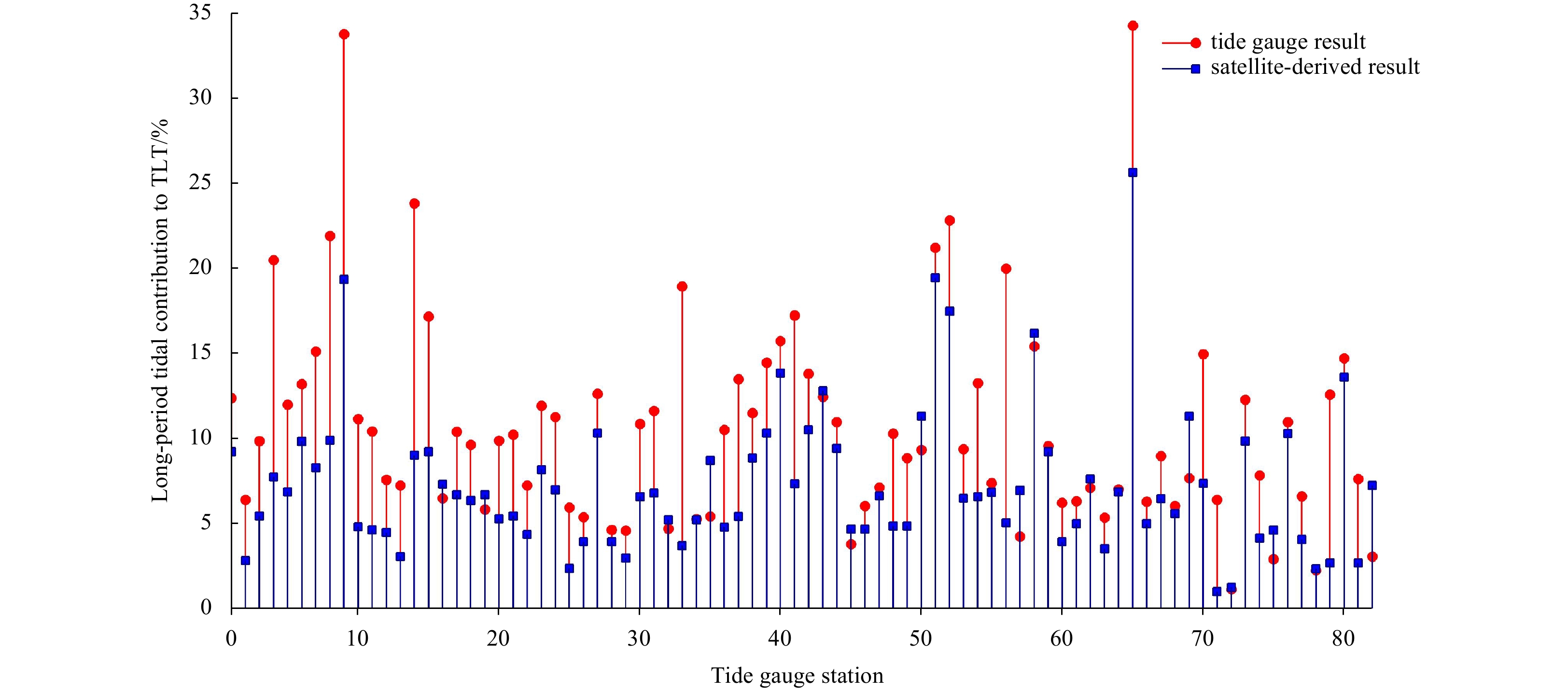
2023, 42(10): 127-136.
doi: 10.1007/s13131-023-2231-5
Abstract:
Global uniform chart datum (CD) surface construction is the basic upon which to realize various vertical datums transformation, and is of great importance for geospatial data expression under the same vertical datum. Generally, the CD level is comput...
Global uniform chart datum (CD) surface construction is the basic upon which to realize various vertical datums transformation, and is of great importance for geospatial data expression under the same vertical datum. Generally, the CD level is comput...